
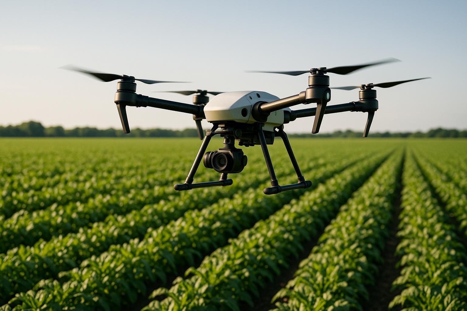
Drones are transforming farming by offering faster and more accurate ways to monitor crops. Equipped with advanced cameras and AI, drones detect plant stress, diseases, and nutrient deficiencies early – before they’re visible to the naked eye. This technology reduces costs, boosts yields, and minimizes resource use like water and pesticides. For example, drones can cut chemical usage by 45% and survey up to 52 acres per hour.
Key points:
- Efficiency: Drones save time by surveying large areas quickly.
- Precision: Advanced imaging (like multispectral and hyperspectral) pinpoints issues early.
- Cost Savings: Farmers report up to 40% reductions in pesticide use.
- Environmental Impact: Lower chemical runoff and CO2 emissions.
- Market Growth: The agricultural drone market is projected to reach $6 billion by 2025.
While drones offer great benefits, challenges like high upfront costs, technical expertise, and weather dependency need to be considered. Starting small with basic crop monitoring can help farmers gradually integrate this technology into their operations.
Monitoring Crops using Drones, Hyperspectral and Machine Learning
Core Technologies in Drone Crop Monitoring
Drones equipped with advanced imaging and AI are transforming how farmers monitor crops, offering insights that go far beyond traditional methods. By understanding these technologies, farmers can choose the right drone systems to meet their operational needs. Let’s dive into the imaging technologies that power these systems.
Multispectral and Hyperspectral Imaging
Central to drone crop monitoring are cameras capable of capturing plant data that’s invisible to the naked eye. Multispectral imaging focuses on 5 to 10 specific light wavelengths, including visible and infrared light, to detect early signs of plant stress. Hyperspectral imaging, on the other hand, analyzes hundreds of narrow wavelengths, offering an even more detailed view – ideal for identifying diseases before visible symptoms appear. While multispectral sensors process data faster, hyperspectral sensors excel in precision, which is critical given that plant diseases contribute to $33 billion in losses annually in the U.S. alone.
Drone cameras are designed for efficiency and accuracy. For example:
- The DJI Mavic 3 Multispectral can survey up to 200 hectares in a single flight.
- The MicaSense RedEdge-P achieves a resolution of 2 cm from a 60-meter altitude.
- The Altum-PT captures six synchronized spectral bands, including thermal infrared, with a ground resolution of 1.2 cm at 60 meters.
Each spectral band captured serves a specific role in crop analysis:
| Spectral Band | Wavelength | Application |
|---|---|---|
| Near-Infrared (NIR) | 750–950 nm | Ideal for studying biomass and canopy density |
| Red Edge | 700–740 nm | Detects early signs of vegetation stress |
| Red | 620–750 nm | Useful for evaluating overall plant health |
| Green | 495–570 nm | Indicates chlorophyll levels and plant vigor |
| Blue | 450–495 nm | Enhances water and vegetation analysis |
These bands are the foundation for calculating vegetation indices, which reveal the health of crops.
Vegetation Indices: NDVI and Beyond
Raw spectral data becomes actionable through vegetation indices – mathematical tools that translate light reflection into indicators of crop health. The most widely used is the Normalized Difference Vegetation Index (NDVI), which compares near-infrared and red light reflections to measure plant vigor. NDVI values range from –1 to +1:
- +1: Dense, healthy vegetation.
- 0: Sparse or stressed crops.
- –1: Bare soil or dead plants.
NDVI maps, often color-coded, allow farmers to quickly assess field conditions. Beyond NDVI, other indices provide more specific insights:
| Index | Description | Use Cases | Formula |
|---|---|---|---|
| NDVI | Measures vegetation health using NIR and Red light | Identifies stressed crops versus healthy ones | (NIR – Red) / (NIR + Red) |
| NDRE | Focuses on leaf chlorophyll content | Early detection of nitrogen deficiencies | (NIR – Red Edge) / (NIR + Red Edge) |
| OSAVI | Reduces soil brightness interference | Useful for sparse vegetation and soil conditions | (NIR – Red) / (NIR + Red + 0.16) |
| GNDVI | Highlights plant vigor using Green and NIR | Tracks chlorophyll and nutrient uptake | (NIR – Green) / (NIR + Green) |
Ramón Pagán, a mapping expert and president of Caribe Drones, highlights their impact:
After introducing mapping and crop analysis reports to farmers, they could see their field from another perspective. Agremo is helping us bring essential information to farmers which were impossible to get until recently.
Using AI and Machine Learning
AI takes drone imagery to the next level by converting it into precise, actionable insights. Algorithms analyze detailed crop images to detect issues like pests, nutrient deficiencies, and water stress. Studies show AI-powered drones can identify crop diseases with over 90% accuracy. For example, they can detect apple scab disease with 95% accuracy and even achieve millimeter-level precision in monitoring crops. This allows farmers to address problems before they become visible.
Machine learning boosts efficiency further. AI-driven weed control systems, like Blue River Technology‘s Smart Sprayer, have cut herbicide use by up to 90%. On an Iowa corn farm, drones equipped with multispectral cameras and AI analysis increased income by $434–488 per hectare while significantly reducing pesticide application time. AI also predicts pest outbreaks and market trends, helping farmers make proactive decisions.
The DJI Agriculture Smart Farming Team explains the transformation:
Agremo’s AI solution turns DJI’s drone imagery into actionable insights, and its recipe maps make our AGRAS drone a truly intelligent and precise spraying tool.
Data Collection and Processing Steps
Using advanced imaging and AI tools, the process of gathering drone data and transforming it into actionable insights requires meticulous planning and execution. Each phase – pre-flight preparation, data collection, and post-flight processing – plays a crucial role in delivering meaningful results for farmers.
Pre-Flight Planning and Execution
Success begins with solid pre-flight planning. Start by defining your goals: What data do you need? What questions are you trying to answer? Pinpointing these objectives helps guide your approach. It’s also important to understand your drone and sensors, as different equipment performs best at specific points in the growing season.
Timing is critical. Plan flights between 10 AM and 2 PM when sunlight reduces shadow interference. Avoid flying within two hours of sunrise or sunset, and always check weather conditions like wind, cloud cover, and rain.
Set your drone’s altitude and overlap settings carefully, and extend your flight area slightly beyond field boundaries for full coverage. Keep mapping zones within 500×500 meters (1,650×1,650 feet) to maintain safe visual line-of-sight (VLOS) operations.
A pre-flight checklist is a must. Verify battery levels, ensure cameras and sensors are secure and functional, and download offline maps if internet access might be an issue. Assess potential risks to people, property, and the drone itself. For field shapes, choose between polygon and grid missions. Polygon missions are quicker for irregular areas, while grid patterns suit rectangular fields. Also, consider the type of drone: fixed-wing models cover larger areas but need more landing space, while multirotor drones are better for smaller takeoff zones but have shorter flight times. These preparations ensure the data collected is accurate and ready for analysis.
Post-Flight Data Processing
After collecting data, the next step is turning raw images into actionable insights. This is where the real value of drone mapping comes to life. Start by reviewing image quality on-site using a laptop to confirm the data meets standards. If not, identify the issue and re-fly the mission with updated settings.
Processing multispectral imagery involves specialized mapping software that stitches images into mosaics and calculates vegetation indices like NDVI (Normalized Difference Vegetation Index) and CIG (Chlorophyll Index Green).
A practical example comes from Babe Farms in Santa Maria, California. Using an IF800 Tomcat drone equipped with a Sentera 6X multispectral sensor, they mapped 8.47 acres of baby lettuce in just over seven minutes. The data was processed into a CIG map layered on an RGB mosaic, highlighting areas with varying chlorophyll levels. This insight helped guide fertilizer and water use.
The workflow typically includes verifying image quality, georeferencing, and calculating vegetation indices. While much of this is automated, understanding these steps ensures accurate and reliable results.
Data Storage and Access
Once processed, securely storing and accessing data is vital for timely decision-making. Many modern solutions rely on cloud-based platforms to store, process, and deliver insights directly to mobile devices or farm management systems.
The numbers show how this technology is evolving. By 2025, over 70% of top agriculture drone analytics software will use AI-powered image processing, and more than 60 tools will offer real-time field insights through cloud platforms. Additionally, more than 60% of large farms worldwide are expected to adopt drone mapping software for precision farming.
Several platforms stand out in this space. Farmonaut, with a 4.7/5 user rating, offers satellite health mapping, AI-driven advisory tools, and real-time monitoring across web and mobile platforms. Pix4Dfields, rated 4.6/5, excels in crop mapping and creating prescription maps, while DroneDeploy, with a 4.5/5 rating, provides live mapping and agronomic scouting capabilities.
The best platforms integrate drone imagery with ground sensor data, satellite inputs, and weather forecasts to deliver a complete picture. Their dashboards use interactive maps, graphs, and heatmaps to simplify complex information, while mobile interfaces allow farmers to make quick, informed decisions in the field.
Data security and compatibility are also critical. Look for platforms with strong security measures, seamless integration with existing farm management systems, and the ability to export data in standard formats. This ensures your crop health data remains safe, accessible, and useful for long-term analysis and planning.
sbb-itb-593149b
Applications and Benefits of Drone Crop Health Analysis
Drones are making waves in agriculture, offering farmers tools to detect issues early, manage resources effectively, and save money. From spotting diseases before they spread to fine-tuning water usage, drones are changing how farms operate, bringing precision to every step.
Early Detection of Crop Problems
Drones can identify subtle changes in light reflection that hint at diseases, pests, or nutrient deficiencies, often before symptoms are visible to the naked eye. Considering that plant pests and diseases cause the loss of up to 40% of global crop production annually – amounting to an estimated $220 billion in economic damage – this early detection is invaluable. Drones can cut field inspection times by up to 90%, and when paired with AI, they can analyze patterns linked to pest infestations and diseases.
The impact is clear in real-world examples. In Tamil Nadu, a farmer saw a 15% increase in banana yields thanks to drone monitoring. In Punjab, drones helped a farmer control pests in paddy fields, saving about $8 per acre. In Odisha, Vaimanika’s drones managed pest outbreaks in just 48 hours – a task that would have taken a week manually.
Early detection also means farmers can target problem areas with precision, reducing the need for widespread pesticide use and lowering chemical runoff. Some farmers have reported a 30% drop in pesticide use by addressing issues early. In Andhra Pradesh, chili farmers noted healthier bee populations after adopting drone technology.
These quick responses not only protect crops but also pave the way for smarter resource management.
Precision Irrigation and Resource Management
Water scarcity is one of agriculture’s biggest challenges, and drones are helping farmers tackle it head-on. Equipped with thermal sensors and multispectral cameras, drones can pinpoint areas suffering from water stress. This is critical, especially as projections suggest that, under severe climate scenarios, water scarcity could affect up to 84% of global cultivated areas.
Drones maximize water efficiency by applying it precisely where it’s needed. Spraying drones, for instance, can cover around 25 acres per hour, ensuring accurate application of water and chemicals. Beyond irrigation, drones create detailed maps showing soil quality, nutrient levels, and plant growth. This data helps farmers identify nutrient deficiencies or early signs of disease, allowing for timely interventions and significant water savings.
By using this technology, farmers can adopt targeted irrigation strategies that reduce water waste while improving crop quality and yield.
Cost and Farming Benefits
The financial advantages of using drones in farming are hard to ignore. Research shows that drone monitoring can boost yields by up to 15% and cut pesticide usage by 35–40% through precision spraying.
"Drone-based crop analysis reduces costs, improves decisions, and boosts profitability." – Midwest Drones
The agricultural drone market has grown rapidly, from $1.2 billion in 2020 to an expected $6 billion by 2025. In South Korea, drones now handle about 30% of agricultural spraying. Unlike traditional crop scouting, which is time-consuming and labor-intensive, drones can survey large areas quickly, delivering high-resolution images that outperform pixelated satellite visuals.
Precision farming systems linked to drone technology have been shown to increase yields by up to 5%. While the initial costs of drones may seem high, the long-term benefits, including time savings and reduced labor costs, often outweigh these expenses. For example, hiring a commercial drone operator typically costs around $600 per job site.
"Drone crop analysis is revolutionizing the way farmers manage their fields, offering real-time insights, enhanced productivity, and significant cost savings." – TJ Aerosense
Pros and Cons of Drone Technology
Expanding on earlier discussions about operational insights, let’s delve into the advantages and challenges of using drones in agriculture. While drones bring advanced tools for tasks like analyzing crop health, they aren’t a one-size-fits-all solution. Farmers need to weigh the benefits against the hurdles to determine if this technology aligns with their specific needs.
Drones shine when it comes to precision imaging, capturing patterns and details beyond what the human eye can detect. But alongside these benefits come challenges that farmers must navigate.
One of the biggest advantages is how drones save time and money. They can survey vast areas in a single flight and deliver detailed data in just minutes. But there’s a flip side: regulatory requirements and technical know-how can be significant obstacles. Many farmers lack the training needed to operate agricultural drones effectively, and mastering the technology requires ongoing education.
Another hurdle is the steep upfront cost. High-end drones, advanced sensors, software, and maintenance all add up. For instance, professional-grade spraying drones like the DJI Agras T30/T40/T50 can cost around $50,000, whereas monitoring drones such as the DJI Mavic 3 are priced closer to $3,000.
"Setting up an effective drone spraying or seeding program is complex. From field-charging, tank refilling, and safety protocols, it’s a smart investment to learn industry best practices from people who have mastered this." – Bryan Sanders, President of Homeland Surveillance and Electronics
Weather is another factor. Drones are highly dependent on favorable conditions, and adverse weather can disrupt operations, requiring backup plans.
Comparison Table: Pros and Cons
| Advantages | Disadvantages |
|---|---|
| Precision targeting – Detect soil variations, water stress, and plant health problems for targeted action | High upfront costs – Professional drones range from $3,000 to $50,000, plus software and training expenses |
| Time efficiency – Survey large areas quickly, delivering real-time data | Technical expertise required – Training and ongoing education are essential for effective use |
| Cost-effective operations – Cheaper than manned aircraft for repeated seasonal tasks | Regulatory compliance – Complex aviation rules and licensing can be challenging |
| Enhanced data quality – Provides sharper imagery compared to pixelated satellite images | Weather dependency – Operations can be delayed or canceled due to bad weather |
| Early problem detection – Identifies issues before they’re visible during manual inspections | Integration challenges – May require compatible systems and software for smooth operation |
| Reduced environmental impact – Enables precise pesticide application, minimizing waste | Maintenance requirements – Ongoing upkeep and battery replacements add to costs |
These challenges highlight the operational considerations that farmers must address. They also tie back to earlier points about pre-flight planning and data processing.
Deciding whether to adopt drone technology depends on factors like the size of the farm, the types of crops grown, and how often the technology will be used. As Matthew Johnson from Volatus Aerospace explains:
"There is quite a spectrum of applications for drones in precision agriculture, and trying to ‘do it all’ at once is going to present major problems, especially for someone who has no experience with the technology." – Matthew Johnson, Regional Vice President, Prairies & Director, Education for Volatus Aerospace
Despite the challenges, the growing adoption of drones in agriculture suggests that the benefits often outweigh the drawbacks. Starting with small-scale pilot projects and gradually increasing usage tends to be the most effective approach.
Conclusion
Drones are reshaping how farmers approach crop health analysis. The agricultural drone market, worth $1.2 billion in 2019, is projected to hit $4.8 billion by 2025. Along the way, drones are helping increase yields by 15% while cutting pesticide use by 30% – a game-changer for both productivity and sustainability.
These advancements aren’t just theoretical. Field tests have proven that drones remove much of the guesswork from farming, replacing time-intensive manual inspections with efficient, data-driven insights. By capturing aerial images, drones can identify pest infestations, disease spread, and nutrient deficiencies long before they become visible to the naked eye. Paired with precision farming systems that can improve yields by up to 5%, drones empower farmers to take targeted, timely action.
Key Takeaways
The impact of drones on modern agriculture boils down to a few standout features: multispectral imaging, NDVI analysis, and a structured three-phase workflow (pre-flight planning, data collection, and post-processing). Together, these tools create a powerful monitoring system that delivers actionable results.
For beginners exploring drone technology, it’s wise to start small. Focus on basic crop monitoring and NDVI imagery to spot plant stress early on. Over time, you can expand into more advanced uses like soil health mapping and prescription treatments. While the upfront costs of drones can be substantial, the long-term benefits – higher yields, reduced waste, and early problem detection – often make the investment worthwhile. South Korea’s example, where drones handle nearly 30% of agricultural spraying, highlights the growing acceptance of this technology.
Of course, challenges remain. Weather conditions and technical complexities can still hinder widespread adoption. However, drone scouting has already proven it can cut field inspection times by up to 90%. As precision agriculture continues to advance, drones are set to play a central role in farming practices that aim to produce more with fewer resources.
The future of crop health analysis lies in blending imaging, analytics, and precision techniques. This shift is moving agriculture from reactive problem-solving to proactive, efficient management. Farmers now have the tools to stay ahead of issues, ensuring healthier crops and more sustainable farming.
FAQs
How do drones with advanced imaging technologies help detect crop diseases early?
Drones equipped with multispectral and hyperspectral imaging offer an advanced way to spot crop diseases early. These technologies capture detailed data that highlights subtle changes in plant health, often before any visible signs of disease appear. This early detection gives farmers the chance to respond quickly and stop the disease from spreading further.
Take hyperspectral imaging, for example – it can identify even small traces of disease with impressive accuracy. Meanwhile, multispectral sensors are capable of detecting affected areas as small as 2.5–5.0% of a leaf’s surface. This level of precision enables quicker, highly targeted treatments, which helps minimize crop losses and boost yields. With these tools in hand, farmers and researchers can make smarter, data-driven decisions to safeguard their crops and improve agricultural outcomes.
What challenges do farmers face when using drones for crop management, and how can they address them?
Farmers face a range of hurdles when it comes to using drones for crop management. These challenges include limited technical expertise, dealing with complicated regulations, concerns about safety and privacy, the high upfront costs of the equipment, and the unpredictability of weather, which can disrupt drone operations.
To overcome these obstacles, starting with small pilot projects can be a smart move. This allows farmers to gradually get comfortable with the technology. Professional training or expert guidance can also make the learning curve less steep. Staying up-to-date on local regulations and investing in drones designed to handle varying weather conditions can further ease the transition. By taking these steps, farmers can integrate drones into their operations more smoothly, making the process both practical and efficient.
How do AI and machine learning improve the accuracy and efficiency of drones in crop health monitoring?
Drones equipped with AI and machine learning are transforming the way farmers monitor their crops. These technologies allow drones to deliver highly accurate data analysis and spot potential problems early. For example, drones can detect crop diseases and pests with an accuracy rate that often exceeds 90%, even identifying issues as small as a few millimeters.
AI also processes massive amounts of data to fine-tune the use of resources like water and fertilizers, making farming more efficient. On top of that, it improves yield predictions, providing farmers with actionable insights to make better decisions and boost productivity. This powerful mix of technology and automation is paving the way for healthier crops and smarter, more sustainable farming.
